
Nandi Kund - Ghiya Vinayak Pass Trek
Trek route · Uttrakhand - Garhwal
Duration: 10 Days, 9 Nights, Rishikesh to Rishikesh · Grade: Strenuous · Highest point: 5250 m · Best time: May End - June, Sep - Early October
Overview
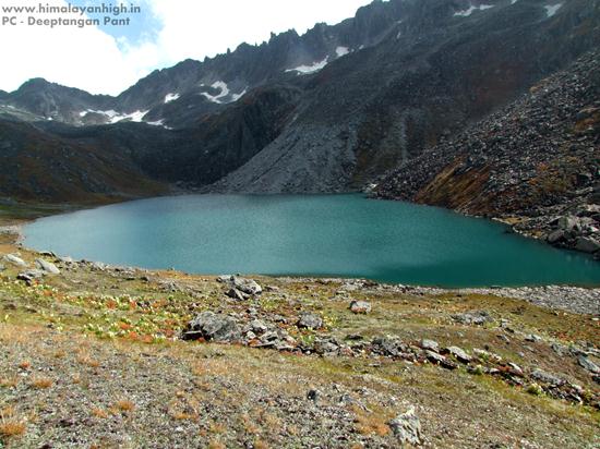
The pristine and holy lake of Nandi Kund
Though, it is not an easy trek, and is a bit strenuous trek, on the other hand, it is not a technical trek as well which makes it doable for any trekker who is physically fit and likes the challenges offered by the Himalayas. The trek involves steep climbs and descends, and some of the patches have no defined trail. Especially, the trek from Kachni Khal to Pandavsera is very easy to get lost without a sound local guide and an expert team. The climb up to the top of the Ghiya Vinayak Pass adds further to make the Nandikund - Ghiya Vinayak Pass trek one of the lesser-known treks in the Himalayas of Garhwal, and thankfully so.
Chowkhamba - The Guiding Light Of The Nandi Kund Trek
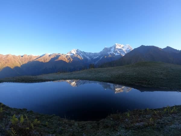
The Chowkhamba Massif dominates the trek to Nandikund for almost 5 days. The best view can be seen from the Buda Madhyamaheshwar where there are over 7 small lakes that reflect the beautiful peak on its surface. From Madhyamaheshwar, it's about 30 minutes climb up to the top of Buda Madhyamaheshwar. The best time to be there is during the sunrise and sunset. Even the peaks of Mandani look beautiful from here.
Nandi Kund - A Pristine Lake
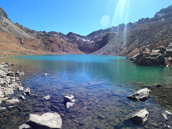
The beauty of this lake cannot be expressed in words. It is not the lake that looks beautiful, but the entire ambience around the place is unforgetful. There is a positive spirit around which uplifts your soul as soon as you get a sight of it. You feel as if you should never leave this place. The turquoise green colour of the lake water with its slow waves settles your heart right into it. You could keep watching the waves and get lost in your own world. The rocky surrounding and gushing wind just add up to the feel.
Ghiya Vinayak Pass - A Thrilling Climb
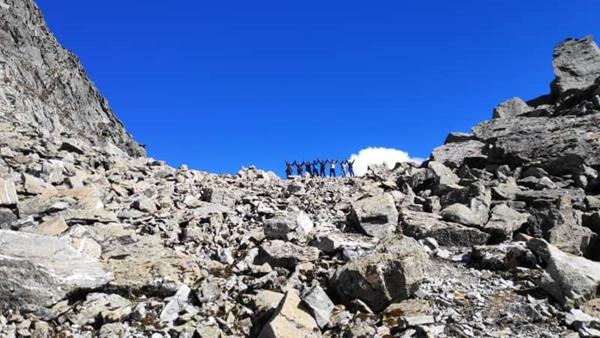
The walk to the top of Ghiya Vinayak pass is not just treacherous through the moraines, but also extremely beautiful and thrilling at the same time. The trail is over the rocky moraine and keeps changing with each season. You need to be extra cautious with every step. A good support team helps a lot or else you might completely lose your way and get lost.
Nanda Devi - From The Nandi Kund Trek
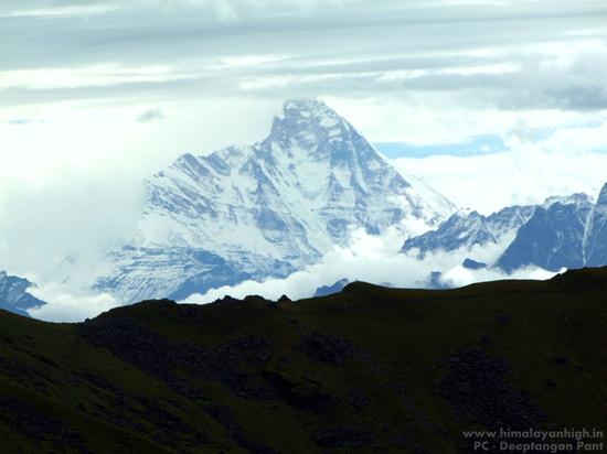
Nanda Devi - The Goddess Mountain stands right in front of you when you climb up the Ghiya Vinayak Pass. Nanda Devi is the highest self-owned peak in India which was once thought to be the Worlds tallest peak until Everest was discovered. The mere sight of this Godly signature mountain is indeed a blessing. The same mountain is also seen from the village of Urgum.
Highlights
- Nandikund is one of the most pious and picturesque high altitude lakes in the Garhwal Himalayas. The lake is very sacred as per the Hindu faith and is named after Nandi - The Bull of Shiva, which was actually a disguised avatar of Lord Shiva. Lord Shiva had taken the avatar of the bull to hide from the Pandavas, who were seeking for him to attain Moksha (freedom from the cycle of life and death and Worldly ties ) after the cruelties of the war of Kurukshetra.
- On this trek, we walk on the same paths as the mythical Pandavas and touch 2 important temples of Panch Kedars - a once in a lifetime journey of the Hindus to attain freedom from the Worldly ties. It is believed that the Pandavas who is mythologically believed to be living during the Vedic Period, built 5 temples to worship Lord Shiva after which they got freedom from their life near Swargarohini. The Bull which Bhima caught in Guptkashi vanished and fragmented into 5 parts where the Pandavas built the Panch Kedar Temples to worship Lord Shiva. These are the Face (Rudranath), Arms (Tungnath), Hair (Kalpeshwar), Navel (Madhyamaheshwar) and finally the Hump of the bull where the revered Kedarnath was built.
- The Nandikund trek offers a great Himalayan journey filled with views of Marvellous high snow-covered mountains of the Garhwal Himalayas, interesting mythical stories and offcourse lovely people who live in this Land Of God. It offers one of the rarest and close-up views of the beautiful Chaukhamba, Nanda Devi and Mandani Parvat. Even the snow land of the Panpatia glacier, Neelkanth, Parvati Parvat are visible from the top of Ghiya Vinayak Pass.
- Crossing the high altitude pass of Ghiya Vinayak Pass is definitely one of the interesting and challenging things to do on this trek. So it's not just a beautiful trek. It's a beautiful, mystical and challenging trek.
- The lush green meadows of Barma Bugiyal, Manpai Bugiyal, Kachni Bugyal need a special mention as these are some of the least visited meadows owing to their difficult access route.
Terrain
forest, bushes, alpine meadows, rocky, snow fieldBest time
The best time to do this trek is in the months of May and June till the earlier days of July before the monsoon sets in. After that, post-monsoon months between September to October is the ideal time to do this trek again. After the Spring season, the pre-monsoon period offers a terrain with lush green grassland and myriads of tiny wildflowers. In the autumn months of September, October and November the winds get drier with time turning the green grasses to a brown shade and offers stable weather for clearer views.
Fitness
It is a strenuous trek and requires good stamina, strength and mental endurance. Come well prepared with a well-hydrated body used to exercises as you will be pushed to extremes. Strong core muscles, shoulders, calves and good cardio health is a basic expectation from anyone who wishes to do this trek
Along the route
11 waypoints the founder mapped in the field, including 9 campsites. Symbols show what each place offers.
- 1Bansi NarayanCampsite Meadow
- 2Ransi stay foodRoadhead Village
- 3Manpai BugiyalCampsite Meadow
- 4Urgum stay foodCampsite Roadhead Village
- 5Barma BugiyalCampsite Meadow
- 6Ghiya Vinayak PassPass
- 7Kachni KhalCampsite Meadow Pass Rocky
- 8Nandi KundCampsite Lake
- 9Madhyamaheshhwar TempleCampsite Meadow Shrine
- 10PandavseraCampsite Meadow
- 11Bantoli stay foodCampsite Village